Wetland in Ohi-yo
Wetland delineation is identifying and defining the boundaries of wetland areas. It is conducted by trained professionals, such as wetland scientists or ecologists, and involves field observations, data collection, and analysis.
The primary purposes of wetland delineation are regulatory compliance, environmental impact assessment, land use planning, conservation, and scientific research. It helps ensure compliance with environmental regulations, assess potential impacts of development projects on wetlands, inform land use decisions, protect and restore wetland ecosystems, and contribute to scientific knowledge and monitoring.
During the process, professionals assess indicators such as vegetation, soil characteristics, and hydrological factors to determine wetland presence and boundaries. The collected data is compared to established criteria and guidelines, and wetland boundaries are mapped. The information is compiled into a comprehensive report, including detailed maps, photographs, field data, and wetland functions and values analysis.
Wetland delineation is essential for effective wetland management, protection, and conservation, ensuring that these valuable ecosystems are correctly understood, preserved, and sustainably used.
Who?
Trained professionals with expertise in wetland science, ecology, or environmental consulting typically do wetland delineation. These individuals may hold degrees in wetland science, ecology, biology, environmental science, or related disciplines. Standard job titles associated with wetland delineation include:
Trained professionals with expertise in wetland science, ecology, or environmental consulting typically do wetland delineation. These individuals may hold degrees in wetland science, ecology, biology, environmental science, or related disciplines. Standard job titles associated with wetland delineation include:
- Wetland Scientists: These professionals specialize in wetland ecology, hydrology, and the identification and assessment of wetland systems. They are knowledgeable about wetland vegetation, soil characteristics, and hydrological indicators.
- Wetland Ecologists: Ecologists focusing on wetland ecosystems often perform wetland delineation. They deeply understand wetlands' ecological processes and functions and can identify critical indicators of wetland presence.
- Environmental Consultants: Environmental consulting firms often have experts specializing in wetland delineation. These consultants provide professional services to assess and document wetland boundaries and characteristics for various projects and regulatory compliance.
- Regulatory Agency Staff: Staff members of regulatory agencies, such as the U.S. Army Corps of Engineers or local environmental agencies, may also conduct wetland delineation. They enforce wetland protection regulations and may assess wetland boundaries as part of their regulatory responsibilities.
What?
Wetland delineation is a process used to identify and define the boundaries of wetlands and other water bodies to determine their extent and characteristics. It is essential in wetland assessment and regulatory compliance, particularly in environmental impact assessments, land development projects, and natural resource management.
The delineation process typically involves a combination of field observations, data collection, and analysis. Trained professionals, such as wetland scientists or ecologists, visit the site to assess and document the presence of hydrological indicators, vegetation, and soil characteristics indicative of wetland environments. These indicators can include the presence of waterlogged soils, specific types of wetland plants, and evidence of hydrology, such as standing water or saturated soil conditions.
The collected information is compared to established criteria and definitions outlined by regulatory agencies or wetland delineation methodologies, such as the U.S. Army Corps of Engineers Wetland Delineation Manual. These criteria help determine whether an area meets the legal or scientific definition of a wetland.
The delineation report typically includes a description of the site, detailed mapping of wetland boundaries, photographs, field data, and an analysis of the wetland functions and values. This information is crucial for making informed decisions regarding land use planning, environmental impact assessments, and wetland permit applications. It helps ensure that wetlands are adequately protected, mitigated, or managed to prevent adverse impacts on their ecological functions, water quality, and associated biodiversity.
Where?
Wetland delineation is typically conducted in areas where wetlands are present or suspected. This includes various types of landscapes, such as:
Wetland delineation is typically conducted in areas where wetlands are present or suspected. This includes various types of landscapes, such as:
- Construction Sites: Wetland delineation is often conducted on construction sites before development activities begin. This helps identify the presence and boundaries of wetlands so that appropriate measures can be taken to avoid or minimize impacts during construction.
- Natural Areas: Wetland delineation is commonly carried out in natural areas such as forests, wetland complexes, coastal areas, and riparian zones. These areas are often more likely to contain wetlands and are essential for conservation and environmental management.
- Agricultural Lands: Wetland delineation may also be done of farm landscapes, especially when there are plans for land-use changes or agricultural practices that may affect wetlands. This helps ensure that wetland resources are appropriately managed and protected.
- Urban and Suburban Areas: Wetland delineation is sometimes conducted in urban and suburban environments, particularly when proposed land development projects or infrastructure developments may impact wetlands. This helps assess potential impacts and implement necessary mitigation measures.
When?
Wetland delineation is typically done during the early stages of land development projects, environmental assessments, or natural resource management activities. It is essential to conduct wetland delineation early in the planning process to identify the presence and boundaries of wetlands on the project site.
Here are some common scenarios when wetland delineation is conducted:
- Land Development: Before initiating construction or development activities on a site, wetland delineation is often performed to identify and map wetland areas. This information assesses potential impacts on wetlands and determines whether permits or mitigation measures are required.
- Environmental Impact Assessments: When undertaking large-scale infrastructure projects, such as roads, bridges, or pipelines, wetland delineation is conducted as part of the environmental impact assessment process. It helps evaluate the project's potential effects on wetlands and allows for implementing appropriate mitigation measures.
- Regulatory Compliance: Wetland delineation is carried out to comply with local, regional, or national regulations related to wetland protection. Regulatory agencies may require wetland delineation for permit applications, land-use planning, or environmental compliance.
- Natural Resource Management: Wetland delineation is essential for effective natural resource management and conservation efforts. It helps identify and monitor wetlands for protection, restoration, or management purposes.
How?
Wetland delineation involves a systematic process that combines field observations, data collection, and analysis. Here is a general overview of how wetland delineation is typically conducted:
Wetland delineation involves a systematic process that combines field observations, data collection, and analysis. Here is a general overview of how wetland delineation is typically conducted:
- Preliminary Assessment: The process begins with an initial assessment of the study area using available maps, aerial imagery, and historical data. This helps identify potential wetland areas and guides the fieldwork.
- Field Investigation: Trained professionals visit the study area and conduct field investigations. They collect data on vegetation, soil characteristics, hydrology, and other indicators to determine the presence and boundaries of wetlands.
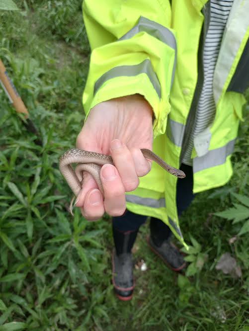
a. Vegetation Assessment: Wetland scientists identify and document plant species in the area. Wetland indicator species, commonly associated with wetland environments, are essential in assessing wetland presence.
b. Soil Analysis: Soil samples are collected and analyzed to assess soil characteristics, such as color, texture, and evidence of saturation or redoximorphic features (indicating wetland conditions).
c. Hydrological Assessment: Field observations are made regarding water presence, such as standing water, saturated soils, or evidence of inundation or flooding. Water levels may also be measured using instruments like piezometers or water level loggers. - Data Analysis and Interpretation: The collected field data is compared to established criteria and guidelines, such as those outlined by regulatory agencies or wetland delineation methodologies. These criteria help determine if the area meets the definition of a wetland.
- Mapping and Reporting: Wetland boundaries are mapped based on field observations, vegetation patterns, soil characteristics, and hydrological data. This information is compiled into a comprehensive report, including detailed maps, photographs, field data, wetland functions, and values analysis.
a. Vegetation assessment is a critical component of wetland delineation, as vegetation patterns provide valuable indicators of wetland presence and type. Here is a detailed description of what is done during a vegetation assessment for wetland delineation:
- Site Selection: Trained professionals select representative sampling points across the study area, considering topography, hydrological conditions, and vegetation diversity. These points are strategically distributed to capture the range of wetland conditions present.
- Vegetation Sampling: At each sampling point, field researchers collect data on vegetation composition, structure, and abundance. Various methods include visual surveys, transects, quadrats, and plot sampling. The chosen method depends on the assessment scale and specific project requirements.
- Plant Species Identification: Vegetation samples are carefully examined, and plant species in the area are identified. Wetland indicator species, which have a high affinity for wetland environments, play a crucial role in wetland identification. These species have specific adaptations to wetland conditions and are reliable indicators of wetland presence.
- Species Abundance and Dominance: Researchers record the abundance and dominance of different plant species at each sampling point. This information helps characterize the vegetation community and its composition within the wetland area. Dominant species are often indicative of specific wetland types or conditions.
- Vegetation Zonation: Wetlands often exhibit distinct zones or ecotones, where different plant communities occur due to variations in moisture availability, hydrology, and soil conditions. Researchers document and map these vegetation zones, which aid in delineating wetland boundaries and understanding the wetland's structure and function.
- Canopy Cover and Structure: The vegetation's cover, height, and structure are assessed. This information provides insights into the wetland's habitat complexity, shading effects, and ecological functions. Canopy cover is often estimated using visual estimates or specialized instruments, such as a densiometer.
- Non-Native and Invasive Species: Researchers also identify and document the presence of non-native or invasive plant species within the wetland area. These species can negatively impact wetland ecosystems, and their identification helps prioritize management actions or restoration efforts.
- Data Analysis and Interpretation: The collected vegetation data is analyzed to identify patterns, species associations, and the overall composition of the wetland vegetation community. Comparisons may be made to regional or national vegetation classification systems to classify wetland types and assist in delineation.
- Reporting: The findings of the vegetation assessment are compiled into a comprehensive report. This report includes detailed descriptions, species lists, photographs, maps, and analysis of the wetland vegetation. It contributes to the overall wetland delineation report, determining wetland boundaries and ecological characterization.
b. Soil analysis is essential to wetland delineation as it provides valuable information about the soil characteristics that indicate wetland conditions. Here is a detailed description of what is done during soil analysis for wetland delineation:
- Soil Sampling: Trained professionals collect soil samples from representative locations within the study area. The number and distribution of soil sampling points depend on the wetland's size and complexity and the project's specific requirements. Soil samples are typically collected using soil augers, corers, or hand tools.
- Visual Examination: The soil samples are visually examined in the field to assess various soil characteristics. Researchers look for signs of wetland conditions, such as soil color, texture, and mottles (spots or streaks of contrasting colors).
- Soil Texture Analysis: Soil texture refers to the relative proportions of soil sand, silt, and clay particles. Researchers determine soil texture using standard laboratory procedures such as sedimentation or hydrometer analysis. Wetland soils often have specific texture characteristics, such as high clay content or loamy textures, indicating wetland conditions.
- Redoximorphic Features: Redoximorphic features are soil characteristics that indicate periods of soil saturation and reduced oxygen conditions. These features are identified through visual examination, including iron or manganese concentrations, mottling patterns, or gleying (a bluish-gray coloration). The presence of these features suggests wetland conditions.
- Organic Matter Content: Wetland soils tend to have higher organic matter content due to the accumulation of plant materials under saturated conditions. Researchers assess the organic matter content of the soil samples through laboratory analysis or visual estimation in the field. High organic matter content is indicative of wetland conditions.
- Soil Profile Description: Researchers describe the soil profiles at each sampling point, including soil horizon depths, color variations, and distinct layers or boundaries. This information helps us understand the soil structure and the vertical distribution of different soil characteristics associated with wetlands.
- Field Moisture Assessment: Researchers assess the moisture conditions of the soil samples in the field, particularly whether the soil is saturated, waterlogged, or exhibits signs of recent or frequent inundation. Wetland soils are often associated with high moisture levels or saturation due to shallow groundwater or poor drainage.
- Data Analysis and Interpretation: The collected soil data, including soil texture, redoximorphic features, organic matter content, and soil profile descriptions, are analyzed and interpreted about established criteria or guidelines for wetland delineation. This analysis helps determine if the soil characteristics meet the definition of a wetland.
- Reporting: The soil analysis findings are compiled into a comprehensive report. This report includes detailed descriptions of soil characteristics, photographs, soil profile sketches, and interpretations of wetland conditions based on the soil data. It contributes to the overall wetland delineation report, supporting the determination of wetland boundaries and ecological characterization.
c. Hydrological assessment is a vital component of wetland delineation, as it focuses on understanding the site's water regime and hydrological characteristics. Here is a detailed description of what is done during a hydrological assessment for wetland delineation:
- Data Collection: Trained professionals gather data on various aspects of the site's hydrology. This includes measuring water levels, observing water flow patterns, and assessing the duration and frequency of inundation events. Hydrological data can be collected through direct measurements, such as water level gauges, piezometers, or visual observations in the field.
- Water Level Monitoring: Researchers install water level gauges or piezometers at strategic locations across the study area to monitor water levels over time. These instruments measure the depth of the water table or surface water and provide data on seasonal fluctuations, variations in water levels, and hydrological regimes.
- Inundation Mapping: Researchers map and document areas that experience periodic or permanent inundation. This involves visual observations and documentation of evidence such as watermarks, sediment deposits, or specific wetland vegetation adaptations to flooding. Mapping inundation areas helps identify wetland boundaries and characterize the wetland hydrology.
- Surface Water Flow Assessment: Researchers assess surface water flow patterns within and around the wetland area. They observe the direction and velocity of water flow, identify any surface water inputs or outlets, and note the presence of channels, streams, or drainage features that may influence wetland hydrology.
- Groundwater Influence: The interaction between groundwater and surface water is essential to wetland hydrology. Researchers investigate the presence and influence of groundwater on wetland conditions by measuring groundwater levels and assessing the direction and magnitude of groundwater flow. This information helps us understand the water source for wetlands and their dependence on groundwater.
- Water Quality Analysis: In some cases, water quality parameters such as pH, dissolved oxygen, nutrient levels, or contaminants may be assessed to understand further the hydrological conditions and potential impacts on wetland ecosystems. Water quality data can provide insights into the suitability of the wetland habitat for various organisms and the overall health of the wetland ecosystem.
- Data Analysis and Interpretation: The collected hydrological data is analyzed and interpreted to determine the wetland's hydrological characteristics. Researchers compare the data to established criteria or guidelines for wetland delineation, considering factors such as water levels, duration of inundation, and frequency of flooding events. This analysis helps identify wetland areas and understand their hydrological functioning.
- Reporting: The findings of the hydrological assessment are compiled into a comprehensive report. This report includes detailed descriptions of hydrological conditions, water level data, inundation mapping, surface water flow patterns, groundwater influence, and water quality analysis. It contributes to the overall wetland delineation report, determining wetland boundaries and ecological characterization.
Why?
Wetland delineation is conducted for several important reasons:
Wetland delineation is conducted for several important reasons:
- Regulatory Compliance: Regulatory agencies often require wetland delineation to comply with environmental regulations. Many countries have laws and regulations to protect wetlands due to their ecological importance and the services they provide. By conducting wetland delineation, project developers and landowners can determine if their proposed activities will impact wetlands and whether permits or mitigation measures are necessary.
- Environmental Impact Assessment: Wetland delineation is a crucial component of development projects' environmental impact assessments (EIAs). EIAs evaluate the potential impacts of projects on the environment, including wetlands. By accurately identifying and delineating wetlands, the possible effects on these valuable ecosystems can be assessed, and appropriate mitigation measures can be planned to minimize or offset adverse impacts.
- Land Use Planning: Wetland delineation is vital in land use planning processes. Knowing the location and boundaries of wetlands helps inform decisions on zoning, infrastructure development, and conservation planning. It ensures that wetland areas are appropriately considered in land use decisions to avoid or minimize adverse impacts and to protect these valuable habitats.
- Conservation and Restoration: Wetland delineation is crucial for conserving and restoring wetland ecosystems. By accurately identifying and delineating wetlands, conservation organizations and land managers can prioritize areas for protection or restoration efforts. It helps in understanding the extent and connectivity of wetlands, aiding in preserving biodiversity and maintaining essential ecological functions.
- Scientific Research and Monitoring: Wetland delineation provides a baseline understanding of wetland ecosystems, allowing for long-term monitoring and research. Scientists and researchers can use the delineation data to study changes in wetland distribution, habitat quality, and species composition over time. This information contributes to scientific knowledge, management strategies, and policy decisions related to wetland conservation and restoration.
To obtain specific citations from the U.S. Army Corps of Engineers, the Environmental Protection Agency (EPA), or other local regulatory bodies involved in wetland management and conservation, I recommend visiting their official websites or searching scientific databases or online repositories such as:
- U.S. Army Corps of Engineers (USACE): The USACE has a dedicated wetland regulations and resources webpage. You can find wetland-related information, guidelines, and publications on their website: https://www.usace.army.mil/Missions/Civil-Works/Regulatory-Program-and-Permits/Wetlands/
- Environmental Protection Agency (EPA): The EPA provides information on wetlands and their protection on their Wetlands webpage: https://www.epa.gov/wetlands
- Wetland Regulatory Authorities: Depending on your location, other local regulatory bodies may be responsible for wetland management and conservation. These authorities can vary by state, region, or country. Searching for the relevant environmental agencies or departments in your area to access their wetland-related resources would be helpful.
QDP Quick Guide:
Who: Wetland delineation is typically conducted by trained professionals, such as wetland scientists, ecologists, or environmental consultants, with expertise in identifying and assessing wetland ecosystems.
What: Wetland delineation is identifying and defining the boundaries of wetland areas. It involves assessing various indicators such as vegetation, soil characteristics, and hydrological factors to determine wetland presence and boundaries.
When: Wetland delineation can be conducted at various stages, including before land development or project planning, as part of environmental impact assessments, or for scientific research and monitoring purposes.
Where: Wetland delineation is done in areas where wetlands are present or suspected. This can include various types of wetland habitats, such as marshes, swamps, bogs, and wet meadows.
How: Wetland delineation involves field observations, data collection, and analysis. Trained professionals visit the site, conduct surveys, collect vegetation, soil, and water samples, assess hydrological conditions, and compare the collected data to established criteria and guidelines. The information is then used to map wetland boundaries and compile a comprehensive report detailing the findings and analysis.
& Why: Wetland delineation serves several purposes. It helps ensure compliance with environmental regulations related to wetland protection, assess the potential impacts of development projects on wetlands, inform land use decisions and planning, contribute to wetland conservation and restoration efforts, and advance scientific understanding of wetland ecosystems.
-XK Bromley, Principal Investigator/Author